Aerial mapping allows large, complex and inaccessible areas to be measured quickly and in considerable detail. D2R Survey Ltd combines professional survey control with high-resolution aerial photogrammetry and LiDAR to produce accurate topographical survey data, point clouds, orthophotography, 3D models and CAD drawings.
Our current survey platform is the DJI Matrice 400, equipped with the Zenmuse P1 full-frame photogrammetry camera and Zenmuse L3 LiDAR system. This gives us the flexibility to select the most appropriate method for the terrain, vegetation, structures and required deliverables rather than relying on photography alone.
Particularly suited projects are:
- Infrastructure sites such as power stations and ports where ground access is restricted.
- Large rural development or mapping sites where ground surveying would be inefficient in comparison.
- River corridors, embankments, quarries and landslips.
- Forestry either for ground surface extraction or tree canopy and vegetation analysis.
- 3D visualisation of existing scenes with 3D design assets
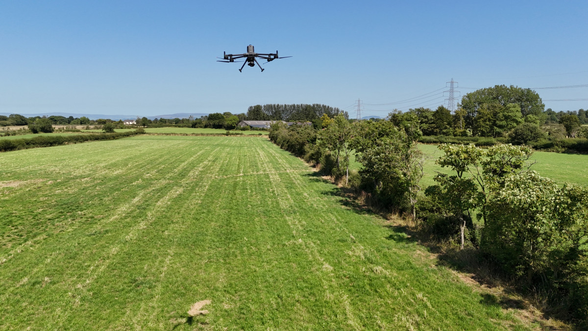
Photogrammetry – DJI Zenmuse P1
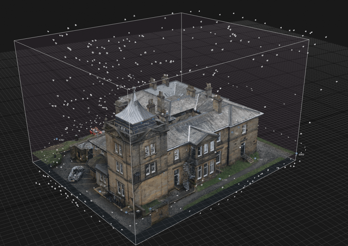
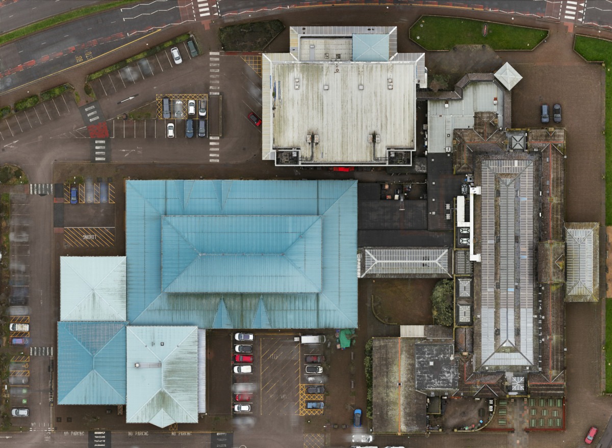
The P1 is a full-frame aerial survey camera designed for high-accuracy photogrammetry. Large numbers of overlapping, georeferenced photographs are captured systematically and processed to generate dense colour point clouds, textured 3D models and high-resolution orthophotography.
Ground control and independent check points are measured using survey-grade GNSS and total station equipment, tying the aerial data into the same coordinate system as a conventional land survey. This is survey grade drone mapping.
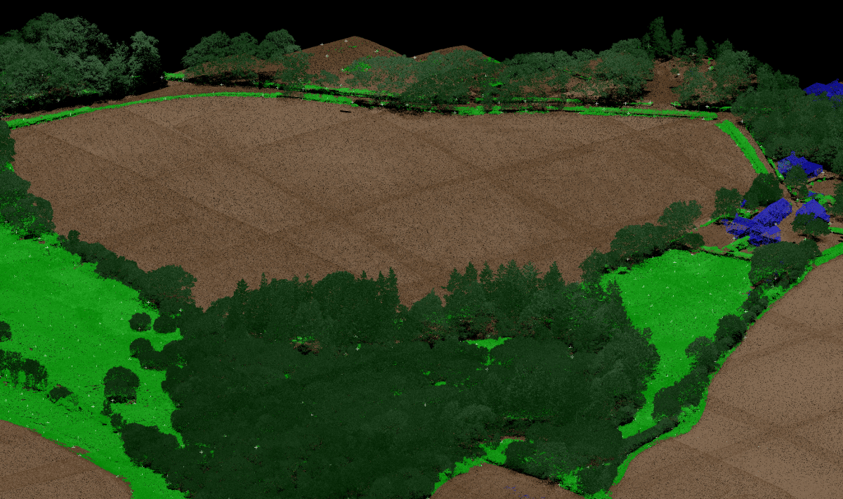
LiDAR – DJI Zenmuse L3
LiDAR measures the landscape directly using laser pulses rather than deriving geometry solely from photographs. It is particularly useful where vegetation, complex terrain, shadow or restricted visibility make conventional photogrammetry less effective.
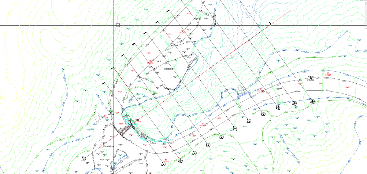
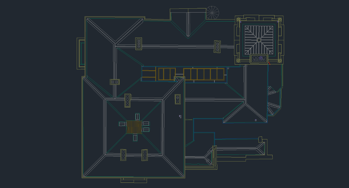
The resulting point cloud can be classified and combined with conventional survey observations to produce terrain models, contours, sections and topographical drawings.
Deliverables
- Topographical survey CAD drawings
- Contours and cross sections
- Digital terrain and surface models
- Stockpile measurement and volumetric analysis
- Orthographic photo mosaics scaled and on grid
- 3D textured building models
- Reality-based 3D environments for architectural visualisation
- Roof inspections and condition reports
- Site progress photography
Drone Roof Inspections & Condition Reports
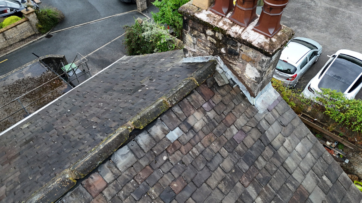
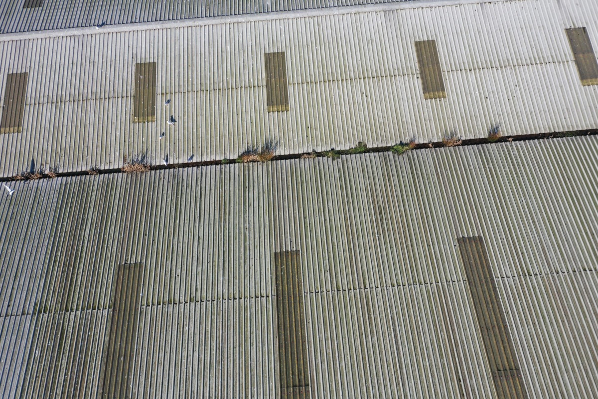
Drone roof inspections provide a safe and efficient way of examining roofs, chimneys, gutters, parapets and other areas that are difficult to access from the ground. High-resolution aerial photography can provide detailed images of the roof covering and associated features without the need for scaffolding or other access equipment. These images are from our DJI Mini 4 Pro.
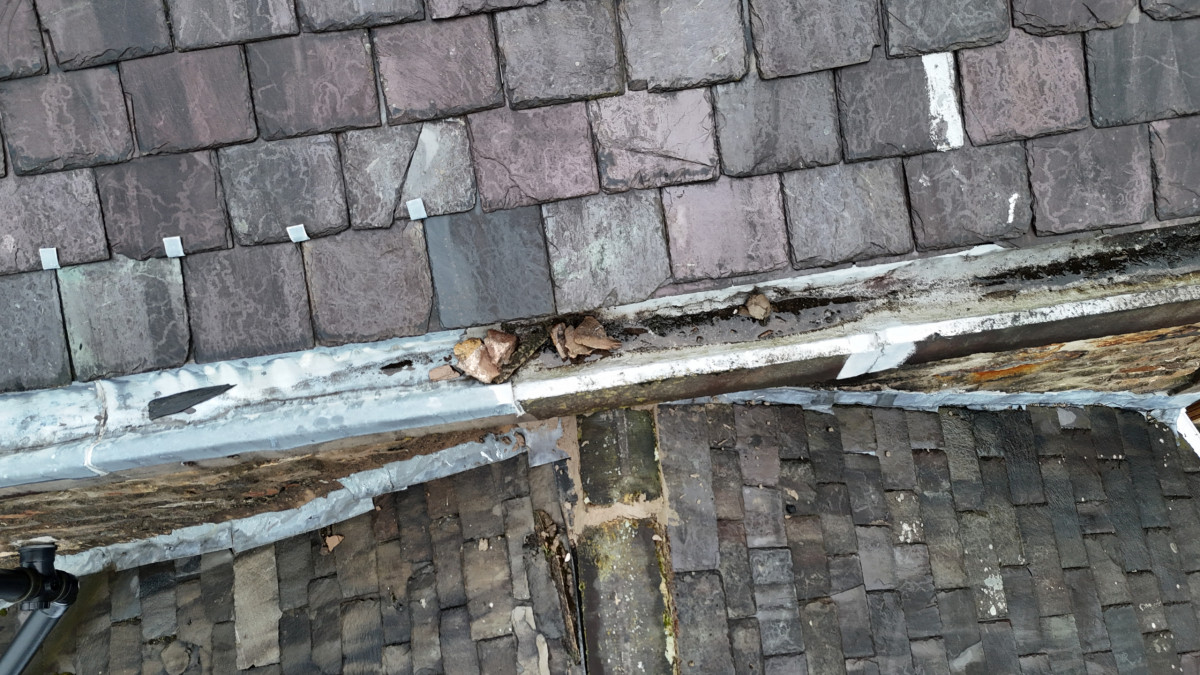
Where required, we can also provide roof condition reports for domestic and commercial properties, with the imagery reviewed by an experienced roofing specialist. This combines detailed aerial inspection with many years of practical roofing knowledge to identify and document visible defects, deterioration and maintenance requirements.
Drone Operations
D2R Survey Ltd operates under a CAA PDRA01 Operational Authorisation, allowing us to undertake drone operations in the Specific Category, including work within residential, commercial, industrial and recreational areas where operations with larger unmanned aircraft would otherwise be significantly restricted.
Our remote pilots hold the required General VLOS Certificate (GVC) and flights are undertaken in accordance with our CAA Operational Authorisation and Operations Manual. Each project is planned individually, taking account of the site, airspace, surrounding properties, roads, people, weather and other operational risks.
Operations are conducted within Visual Line of Sight (VLOS) and within the limits of the Operational Authorisation. Where necessary, appropriate permissions, site controls and additional personnel are put in place to allow the survey to be undertaken safely while minimising disruption to the site and surrounding area.