Measured building surveying, but with higher resolution 3D scanning and photogrammetry. Every stone can be measured, digitized, 3D modelled and drawn in 2D. Photogrammetry is the extraction of 3-dimensional measurements from 2-dimensional photographic images. Superior detail can be recorded.
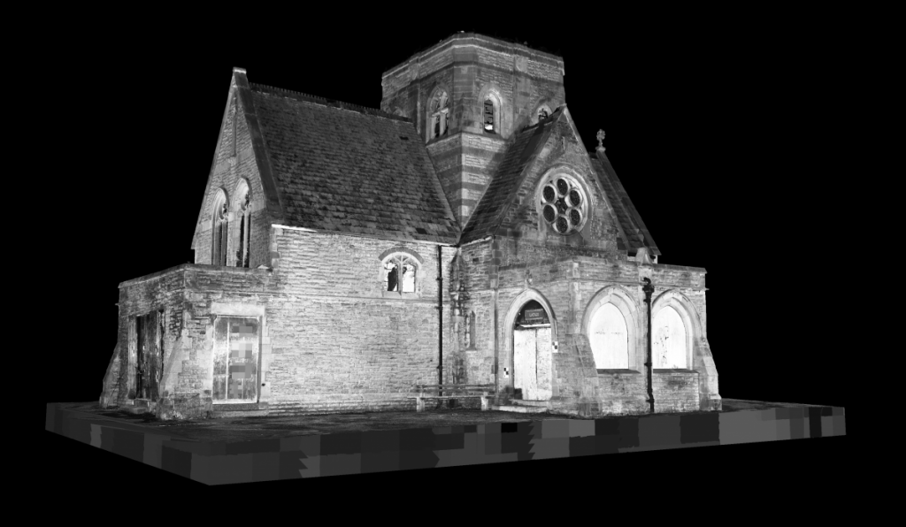
The Chapel, Heaton Cemetery, Bolton. Now demolished, but here digitally preserved. Planning applications to demolish require existing drawings as a record. We rendered orthographic projections of the scan data and cut floor plan slices instead of producing time-consuming CAD line work drawings.
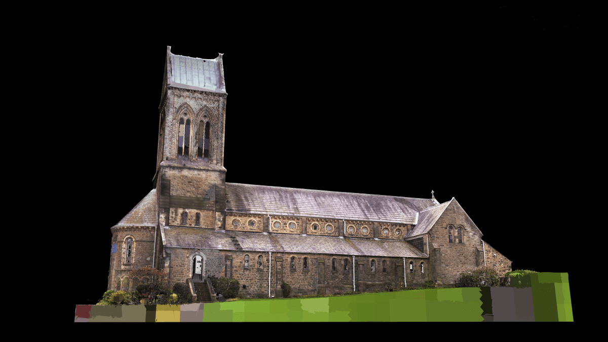
St Paul’s Church, Lancaster. Measured for roof repair works, 3D scanned, externally in colour.
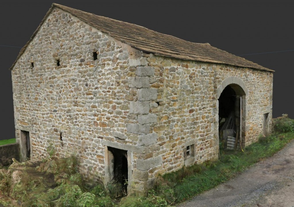
Probably the most highly surveyed barn in the country. 3D Scanned and photographed including using a drone.
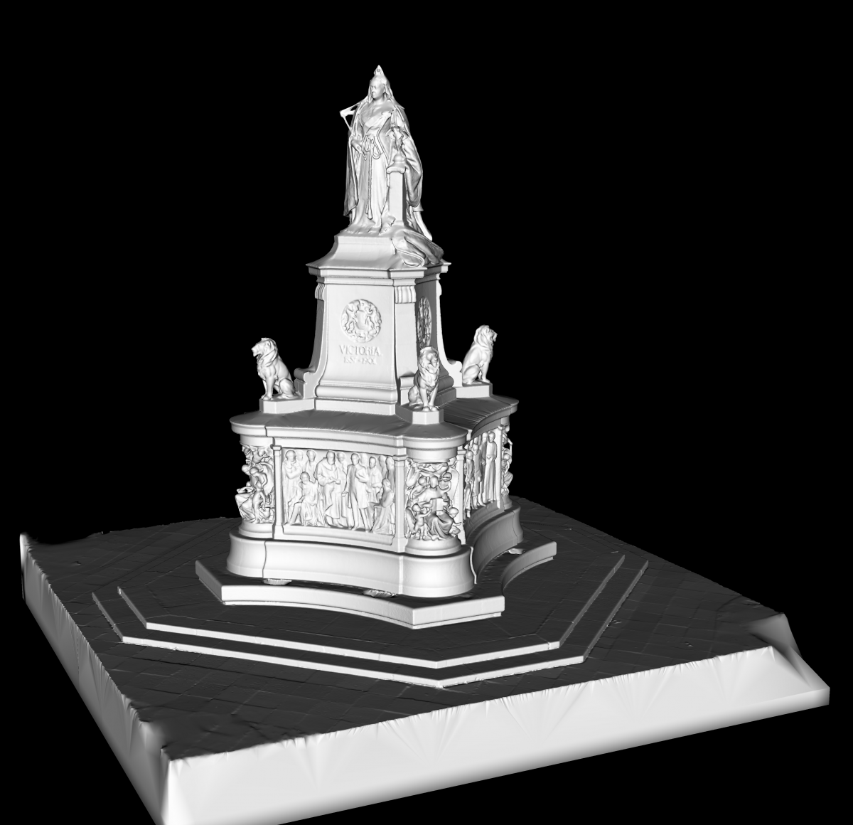
The statue in Dalton Square, Lancaster. 3D laser scanned and modelled for a planning application.